Saturday, November 13, 2010

+ to Hermosa Beach and back


When I was 9, my uncle visited us from Arizona and taking pity at my lack of wheels, bought me a purple bicycle which I learned to ride quickly enough, though not very skillfully. It was also the start of an early onset growth spurt (one which sadly, did not keep pace into my teendom) and as such, I sadly outgrew that bike just as quickly. It was the one and only time I rode a bike in Australia.


22 years later, lured by Ben's promise of an exciting outdoors SoCal lifestyle that I too could lead, I tried a few times unsuccessfully to get on a spare bike that Ben's workmate had found in a dumpster (it wasn't as bad as it sounds). It was an exercise fraught with sweat and tears and frankly, could've scarred me for life. Lucky I found Ron Durgin through the League of American Bicyclists. A few dedicated lessons in the carpark by the beach later, and a bonus accompaniment to shops around town, my confidence and balance on my former foe was restored.


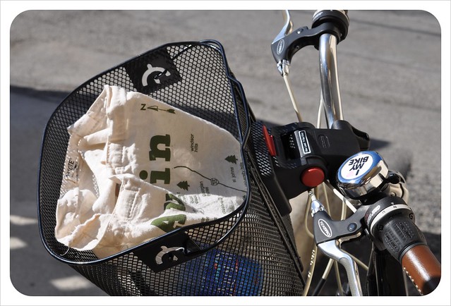
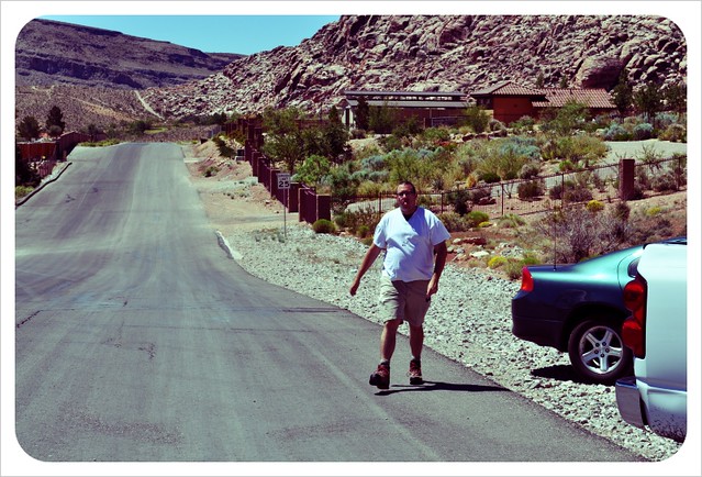
Some baby rides later, Maptote in hand, my sweet new bike and I were ready to venture out with Ben for the famous bike path ride from Santa Monica all the way down to Hermosa Beach (The Strand actually starts in Pacific Palisades, 1 up from SM and ends at Torrance County Beach, 2 down from Hermosa.)


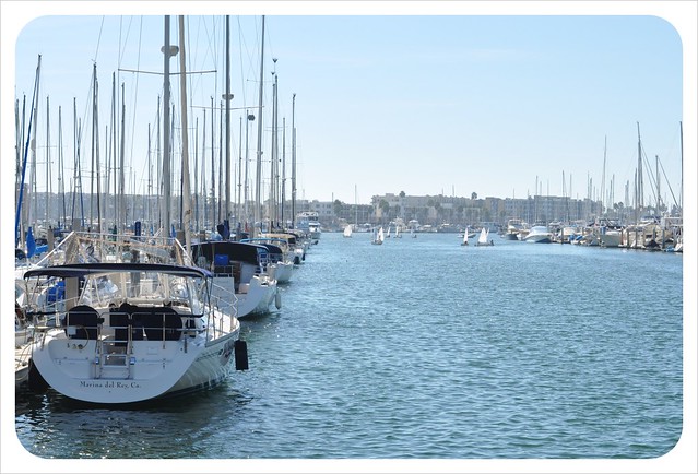
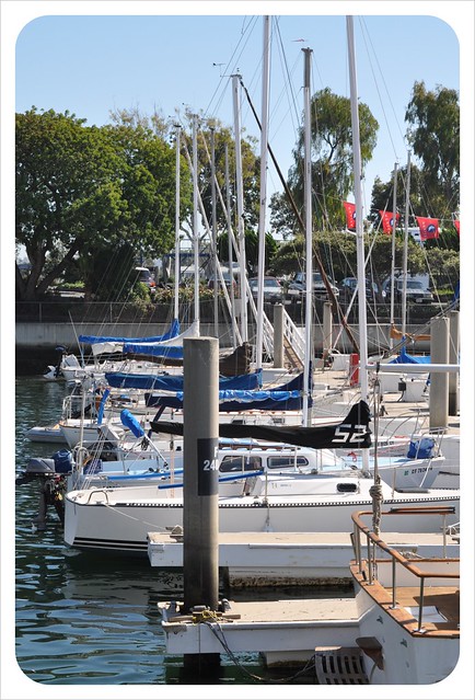
You've already seen photos of SM and Venice beaches from this blog, so the story today picks up from Marina Del Rey. After Venice, the path diverts inland for a short while, along Washington Blvd then turns right onto a park path that runs parallel to the marina and eventually around it.


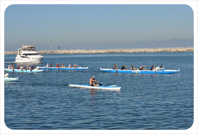
We passed some middle-aged outriggers in training. I'd like to be one of them when I'm older.


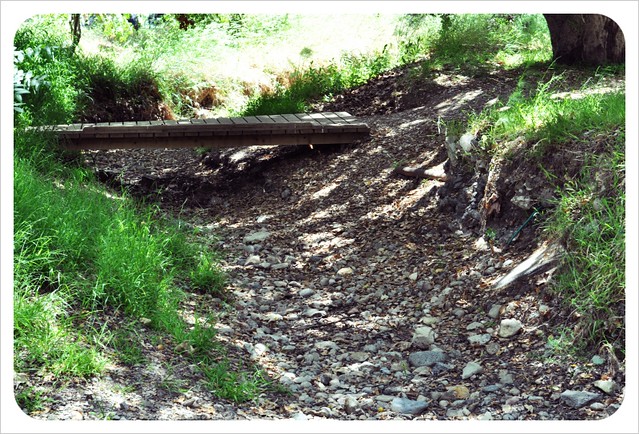
After the marina, we joined a small part of the Ballona Creek path which runs east-west, until we hit the lovely footbridge.


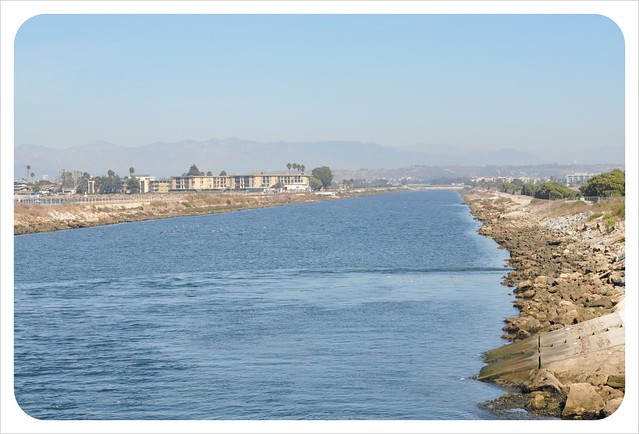
We set our bikes down on the bridge and strolled along the Ballona Creek Walkway.


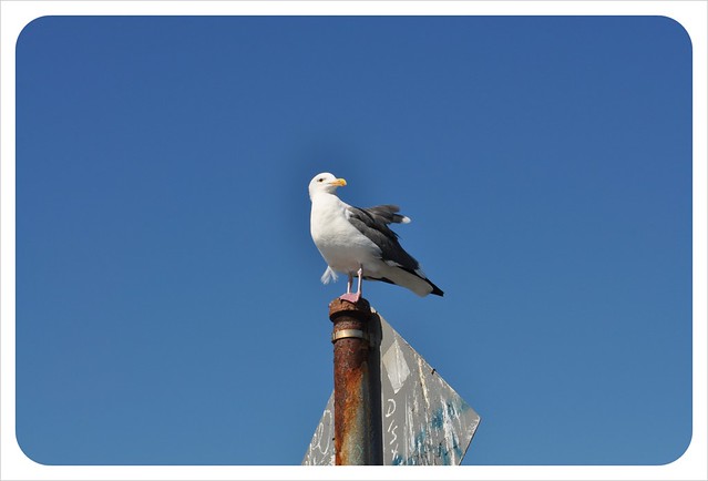
And met an old timer.


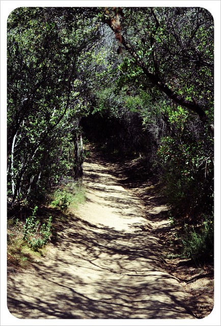
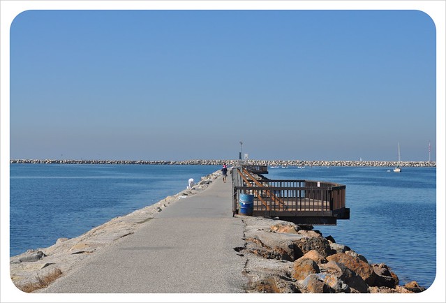
At this bridge point after the creek, the path turns left, southbound and from there it gets even more serenely lovely.


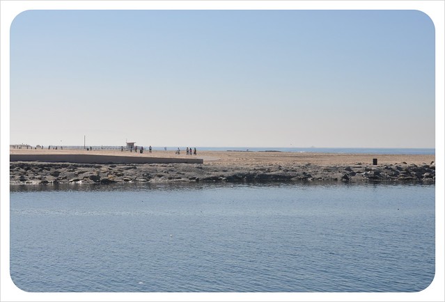
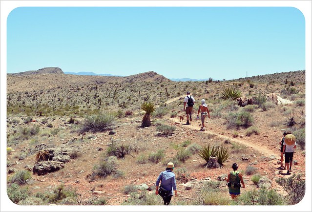
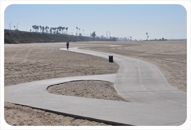
Dockweiler Beach has the nicest stretch of relative flatness, open space and and the least amount of beachgoers because of fewer parking options and the LAX planes flying overhead.


And thoughtfully the entire bike path is really well stocked with toilets and other rest areas (for me to catch my breath).


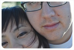
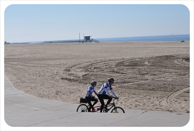
I think it's still Benj's dream that I tandem-cycle with him. Unless I'm donning flares, mutton chops and chunky glasses ala The Goodies, I think they look non-intentionally dorky. Or unless I am part of a power couple like the one below.


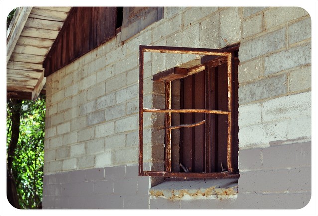
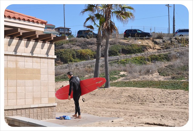
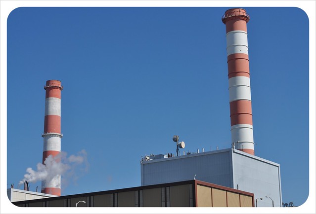
This El Segundo stretch was kind of odd. On one side, a massive power plant right on the edge of the path, and the other, a popular destination for surfers and other more active beach folk. However, it is also really scenic owing to the path being so much closer to the water than at any other point, Ballona Creek notwithstanding.


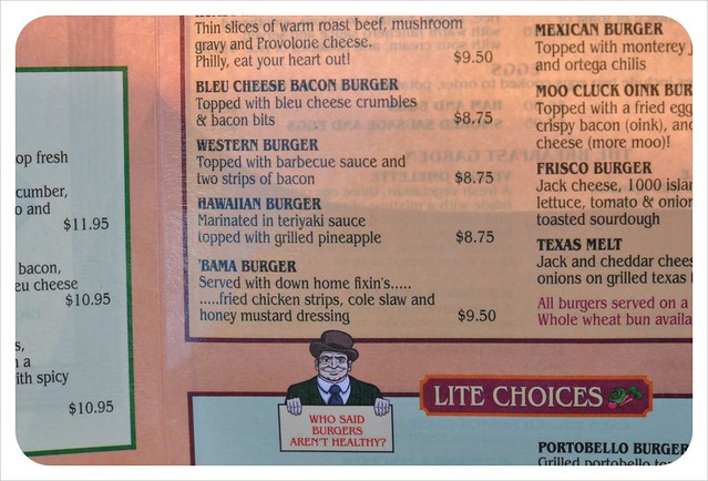
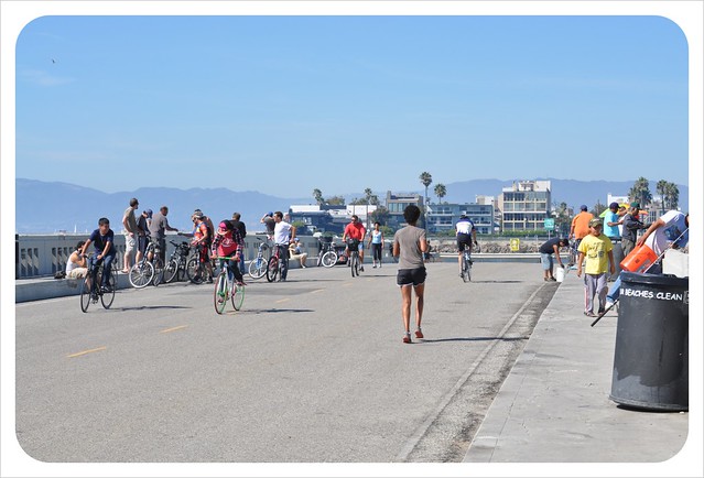
After walking our bikes through the crowded Hermosa Beach strand, we decided this would be the turning point, and end of our ride for this time. I forget the name of the Irish pub we stopped at, but it's right on the corner of the main Hermosa row. Note, the following photo has been included to highlight the "Bama Burger" (probably named after me, if my friends are anything to go by).


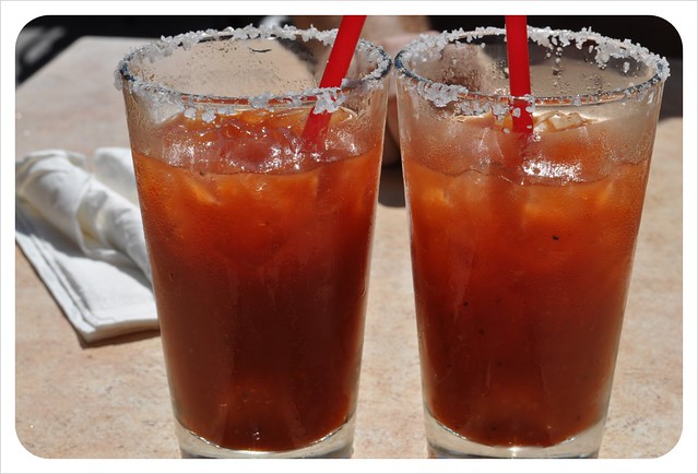
And my filling fish'n'chips lunch was bookended by some tasty bloody marys. I would've had even more if I had realised how cheap they were to begin with.


From bloody marys back to Ballona bridge seemed to take an eternity, marked with MANY rest stops for me (I blame the chips I ate) and barely enough energy to lift the camera to take this photo, yikes. I do remember though, how I literally threw the bike to the ground to get off it and look over the bridge.


By the end of it, the 40-mile round trip completely took it out of me. I was spent, and I went home and "napped" for 4 hours straight!

Saturday, October 23, 2010

+ Bergamot Station


What was once a trolley station until 1953, and then a manufacturing site until 1987, is now a complex of art galleries and museums located smellingly close to the Santa Monica dump. But don't let that put you off (you can't smell the dump... much).


Hiromi Paper


A school kids project on the hallway leading into the courtyard.


This old dog positioned radomnly upon a block within the gallery sat so still, it was a little creepy.


"Baby Crazed" by Ed Moses, up close. From a distance though it looked like different paper stocks. My favourite set of the day.


"Luminesence" by Arik Levy in the Santa Monica Museum of Art.


Tuesday, July 20, 2010

+ Temescal Canyon Loop

I realised I never got around to posting pictures from my very first hike in LA. Whoops. We're lucky to live so close to many hikes within the Santa Monica Mountains, a range which encompasses various state parks and reaches from the Hollywood Hills to Point Mugu (pronounced 'magoo' not 'moogoo' like I have a tendency to do).


Our trusty guide is an easy to navigate book I picked up at REI - Day Hikes Around Los Angeles by Robert Stone.


Our first adventure was to a popular trail in Topanga State Park, no more than 15 minutes drive north. Just off the PCH in Pacific Palisades, the trail is actually two - the Temescal Ridge Trail and the Canyon Trail - and is a great showcase for SoCal hiking with its ocean and city views.


At 4.2 miles with a 1,000 feet elevation (about 300 metres), it's a pretty good workout for a couple hours, especially if you go up the steeper ridge trail first as the book suggests, before returning through the shadier canyon floor.


(looking back on the ridge)

Whilst steep, there are a few points of rest for lovely views of both downtown and the Santa Monica bay, as well as into neighbouring houses (oh to have one those mansions!)


We also brought along a fellow Sydmeysider with us. My friend Maha's boyfriend was in town and was totally keen for the walk. The fact that he was here for a Brazilian jujitsu competition is a good indication of his fitness level relative to ours... it goes without saying he led the way most of the time.


The densely wooded canyon is supposed to run alongside the Temescal Creek, but even calling it a creek is a stretch... a trickle at best! The grotto of rocks at the junction between the trails finds the creek at its most bountiful, though commonsense would advise against drinking anything from the waterfall (unlike the lady we spied trying to fill up her water bottle).


The fragrant groves of sycamore, coastal oak and gum trees (a little bit of home!) make for a relaxing return, and a change from the desert scrubs of the ridgetop.


Just before finishing in the carpark, there is a little picnic area where we saw people setting up for a wedding ceremony, and a seemingly abandoned old hut (a nice little fixer upper?)


We also stopped in at the rather sad visitors centre which was lacking electricity from a recent fire, and offered not much more than a few ancient maps and drinks in a non-working fridge. It was a wonderfully kitsch at least.


Temescal Canyon Loop hike
Hike LA guide
Local Hikes guide
Temescal Gateway Park page

Friday, July 16, 2010

+ Vegas baby!


To celebrate Memorial Day last month, Ben and I drove out past the wonderful Zzyxz Rd exit and spent a week in Las Vegas visiting friends Rob and Mary.


Yes, a lot of time was spent in casinos but I think you'd be fooling yourself if you didn't have a go at the slots at least once. Plus I played roulette for the first time! (I didn't win but the stream of free strawberry daiquiries helped ease the suffering somewhat).


First night in, we went to see ostensibly George Clinton and the Parliament-Funkadelic at Red Rock Casino. I say ostensibly because George never appeared! (though the P-Funk kept the lie alive the whole night, promising an appearance at each break). Nevertheless a good time was had in the blistering cold desert night winds as boogies were shaken and feet splashed (not mine!) in the many pools around the stage.


We also spent the tail-end of one night (post-karaoke) downtown which had changed signficantly since the last time I was there (aged 9). Chiefly, it now has a giant LCD ceiling covering most of the drag, including the iconic cowboy sign. I can only wonder about the electricity bill for such a thing, which was supposed to have been erected to generate more tourists to the area (luring them from the more popular Strip establishments). I'm not sure if it's been successful, but it certainly promotes that aspect of 'timelessness' that pervades the atmosphere of all the casinos. Is it midday or midnight? Who cares, let's gamble!


Despite the hours of fun derived from neon lights and the jingle of a thousand poker machines, the highlight of the trip was our hike in Red Rock Canyon.


Driving along big red mountains, few people and a nice sunny day made for a brilliant start.


A pre-hike Benj.


We were very fortunate to have geologist friends of Rob and Mary, and Rob's energetic puppies, lead the way on an unmarked trail used mostly by rock climbers and boulder hoppers.


Up a very steep mountain, and down gently through a dry canyon that during colder, wetter months becomes quite an impressive river.


Vibrant desert blooms dot the rocks,


as do striking wave patterns.


It was thirsty work for everyone but well worth the effort.


Eventually the rocks give way to a gentle, but still rigorous, march back to the cars. Funnily enough the dogs were absolute troopers until this last stretch... something to do with the sand under paw apparently!